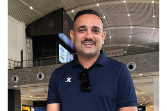
Raj Bikram Maharjan
CEO & CO-Founder, Galli Maps
The rise of technology and internet has brought unprecedented changes to the way we live our lives, more so in current times. With the push of a button, you can now catch a ride at any hour of the day or get food delivered to your doorstep. But Nepal still has a huge gap in navigating houses and landmarks which is not easily possible on other digital map services. Young tech companies such as Foodmandu, Pathao and eSewa have fundamentally altered how businesses operate and the way we use digital maps to find the alleys as they navigate through a city. An aeronautical engineer, Raj Bikram Maharjan, CEO & Co-founder of Airlift Technologies which has introduced Galli Maps, was always interested in making and flying drones as a hobby. He had the opportunity to come back to Nepal to work after he completed his studies and within a couple of months, there was the mega earthquake. “Even though flying drones was just a hobby, I actively used my drones to help victims in the rescue operations during that time,” he says, adding, “I never thought it would be a useful tool for me but my community and neighbouring cities were able to benefit from my drones.” Maharjan recalls a few instances that led him towards launching Galli Maps. As a part of the Kasthamandap Rebuild Committee, he was helping friends gather information on Kasthamandap but realised there was near to null archaeological information or documentation. He then learnt the concept called photogrammetry which he shares is a German technology that merges 2D pictures and converts them into 3D pictures. “This helped immensely in taking forward the reconstruction work,” he shares. Later, he had the opportunity to go to India for South Asia Connect to get trained in entrepreneurial studies. “Till then whatever I was doing was just a hobby but the training helped me understand the nuances of business, about entrepreneurship and most importantly, the value of sustaining in the market,” he states. He, thus, decided to leave his engineering job and started 3D modelling and mapping of heritage sites and different cities which helped in urban planning. In 2020, when the world had come to a literal halt due to the Covid pandemic, Maharjan had ordered for an instrument through an online portal but the delivery company had a major difficulty in locating his house which was situated inside a ‘galli’ (a narrow alley). Since this became a recurring problem every time he bought something online, Maharjan decided to find a solution for it. He also realised that other people were facing similar problems. Since he was already engaged in drone mapping services for local bodies and engineering consultancies, he thought of creating localised maps which could help users navigate all the narrow streets with high-resolution 3D visuals. It was only in 2022 that Maharjan was finally able to launch Galli Maps. “It was inaugurated by the mayor of Kirtipur Municipality as they were the first municipality to introduce house numbering system in the app,” he says. However, he reveals that the beta phase of the app had officially begun in the middle of 2020 and it was in the prototype stage. It took another year to fully develop the app. Moreover, Maharjan shares that they needed another five months to complete their research. He adds that to make sure that the app is as good as it can come, he roped in a friend, Janam Maharjan, as cofounder as he is an information and communication engineer and had experience in antenna design and mobile app development. While talking about the workings of the app, Maharjan says Galli Maps can be a useful tool for finding locations by using the well-known 360 Street view. “We can look up house numbers using the app and get accurate directions to a selection of locations,” he elaborates. The company has been providing its services to e-commerce platforms, ride-sharing companies and WorldLink. Though the app has been gaining popularity in recent days, he explains it was not an easy start. “Creating a map is very time consuming and one needs a lot of resources. Also, it is financially intensive, there is literally no help forthcoming from the government and collecting data is a stupendous task,” he adds. Though there were maps in existence already like Google Maps, Apple Maps and maps.me, Galli Maps has been able to carve a niche for itself and also won the Startup, Product and Rising Star Innovation award at the Infradevelopers ICT Awards. Maharjan says with recognition comes further responsibility and plans to further enhance the service Galli Maps has been providing in the days to come. Using high resolution drone image, the app has house ID numbers of Kathmandu Metropolitan, Kirtipur Municipality, and Kageshwori Municipality. Soon, it will have the house numbers of Lalitpur Metropolitan and other cities and he has plans to expand to other regions too. About future plans, Maharjan shares he wants to install 3D mapping in public transportation services. READ ALSO:
Published Date: April 5, 2023, 12:00 am
Post Comment
E-Magazine

RELATED Innovation